Every map is created from one data file, which has to containt coordinates of points (e.g. Customers). If the map should work fine, you need to make sure that two simple requirements are met:
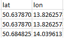
1. Correct Format of Coordinates
Geographic coordinates have to be in the decimal format, e.g. “50.637870”:
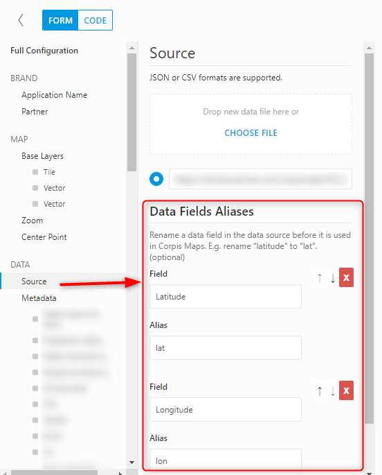
2. Corpis Maps Reads the Coordinates from the “lat” and “lon” Columns
In case the coordinates in your data file are stored in columns with different names e.g. “Latitude” and “Longitude”, simply rename the name od these columns to “lat” and “lon” (first letter is the lowercase letter L) in Corpis Maps Studio in the “Source – Data Fields Aliases” section.
Are you interested in Corpis Maps?
Contact us and try Corpis Maps for FREE for 1 month. In this trial period, we will create a first map for you for FREE.